


1 / 10
Image 1 of 10


1 / 10
Image 1 of 10
View all items from EBTH Select Sale sale
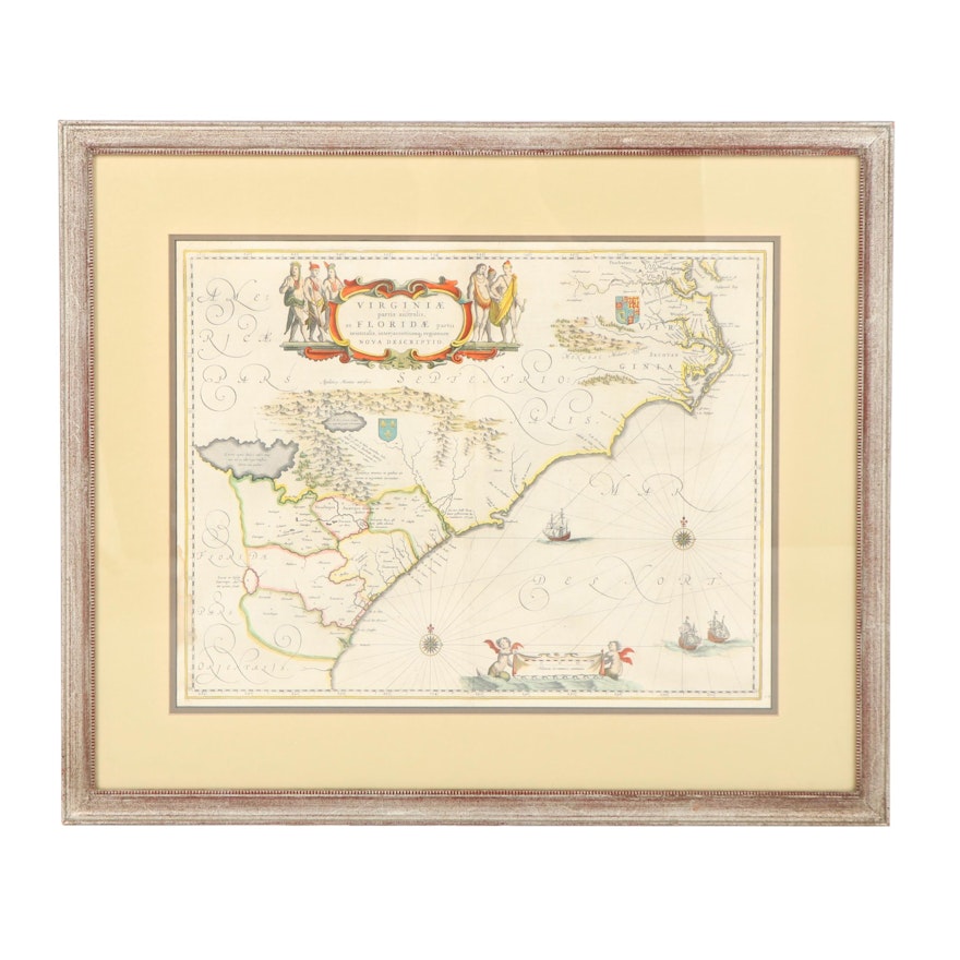
Willem and Jan Blaeu, Map of Virginia and Florida, Amsterdam 1662
Item Details
Engraved map, partially hand-colored with Latin text. (Some staining and offsetting, creasing.) Matted and framed.
Second state: the cherub on the left with a tail. ’Blaeu’s map of the south-east, cartographically it forms a marked improvement on the Hondius map of 1606, from which this was largely derived’ (Burden). The present example is extracted from the first Latin edition: Joannes Blaeu America, quae est Geographiae Blauianae pars quinta liberunus volumen undecimum. Burden Mapping of North America 253.
| Medium on Ground | Hand colored engraving on paper |
| Artist (Nationality, Lifespan) | Willem (1571- 1638) and Jan Blaeu (1596- 1673) |
| Title | Virginiae partis australis, et Floridae, partis orientalis, Amsterdam 1662 |
| Signature | unsigned |
| Map Type | Topographical Map |
Condition
- large stain extending from lower edge along border, creased down the middle
Dimensions
28.25" W x 23.5" H x 1.0" D
- measurement of frame taken
- map measured at 20″ × 15″
Item #
18DAL300-110


