


1 / 7
Image 1 of 7


1 / 7
Image 1 of 7
View all items from Antiques, Collectibles, Home Furnishings & More sale
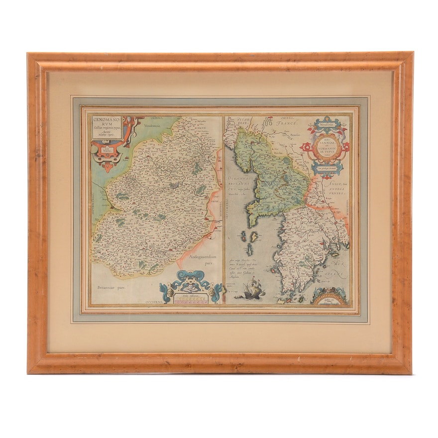
1603 Abraham Ortelius Hand-Colored Engraved Map of Normandy and Brittany
Item Details
An antique map designed in 1594 by noted cartographer Abraham Ortelius (1527 – 1598) for printing and publication in the 1603 volume Theatrum Orbis Terrarum. The map was engraved and features hand-coloring added at a later date. The map depicts the French coastal regions of Brittany and Normandy. It is matted in white with several French lines and is presented behind glass in a natural wooden frame with a hanging wire.
| Medium on Ground | Engraving |
| Signature | Unsigned |
Condition
- map has yellowed and warped slightly, consistent with age. Vertical crease to center from original publication.
Dimensions
29.0" W x 24.0" H x 1.0" D
- measures frame. Visible image area measures 20" W x 15" H.
Item #
18CIN417-188


