


Jean Dezauche Late 18th-Century Hand-Colored Map Engraving of U.S. and Mexico
Item Details
Unsigned
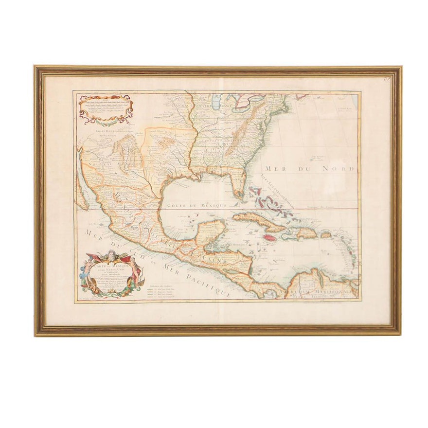
A late 18th-century hand-colored map engraving of the United States, Mexico, and the West Indies, reissued by French map publisher Jean-Claude André Dezauche (fl. c. 1780 – 1838). Fully titled Carte du Mexique et des Etats unis d’Amerique, Partie Meridionale., this map is a reissue of Phillipe Buache (French; 1700 – 1773) and Guillaume D L’Isle’s (French; 1675- 1726) map first issued in 1703. De L’Isle’s successor Dezauche modified the early 18th-century map to reflect new explorations, territorial conquests, and newly established regions of the United States. The map is presented under glass and housed in a gold-tone gesso wood frame. A label from Artistic Picture Frame Co. is adhered to the verso.
Condition
- wear consistent with age; folding crease down center of map; foxing and toning scattered throughout; minor stains, scratches, and finish loss scattered throughout frame.
Dimensions
- measurement of frame; plate marks measure approximately 26.25" W x 19.25" H.
Item #
18DCC239-005


