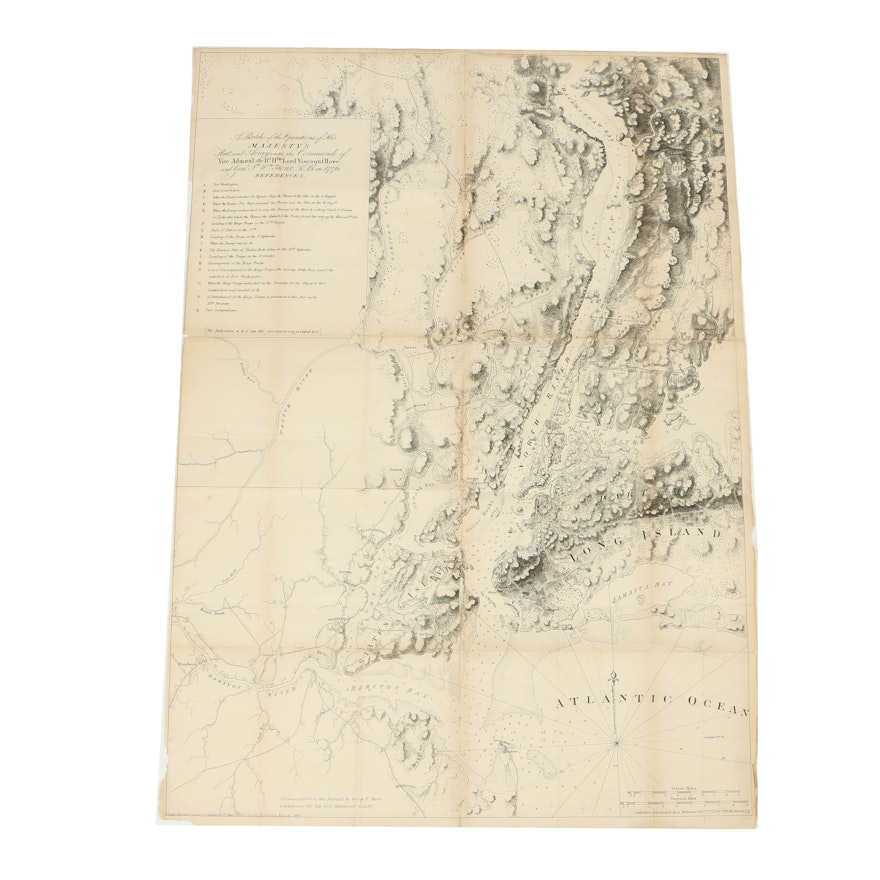


1864 Reissue of Joseph DesBarres' Map of New York City and Harbor
Item Details
A nineteenth-century reissue print of Joseph DesBarres’ (1721-1824) famous 1777 map of New York City and Harbor titled A Sketch of the Operations of His Majesty’s Fleet and Army…. This map was printed for the 1864 issue of Valentine’s Manual of New York. It covers from Sandy Hook northward as far as Haverstraw and the Croton River; it features Staten Island, all of Manhattan, much of northeastern New Jersey, and Long Island as far east as Jamaica. A key is printed to the upper left. The map was originally drawn by cartographer Joseph Des Barres to illustrate the British troop movements during the Revolutionary War. Minute topographic detail is exhibited throughout. Stored folded, the map remains unmounted and unframed.
Condition
- considerable wear consistent with age; tears along edges and throughout folding creases; folding creases throughout; toning and minor foxing scattered throughout.
Dimensions
Item #
18DCC238-595


