


1 / 10
Image 1 of 10


1 / 10
Image 1 of 10
View all items from Antiques, Fine Art, Collectibles & More sale
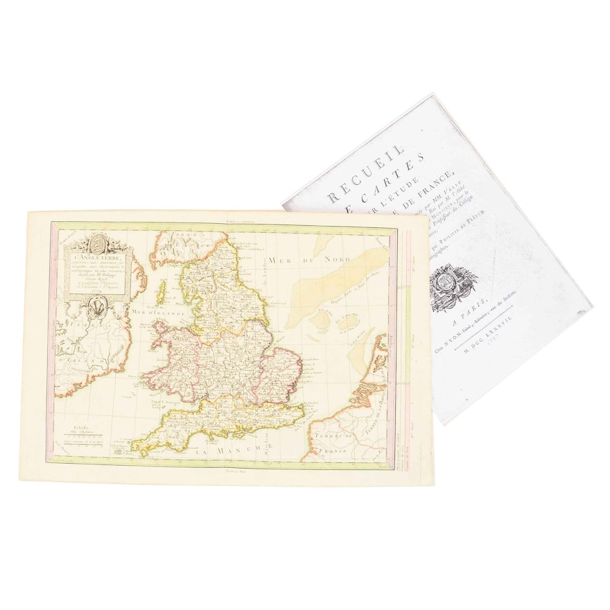
1787 Unframed French Map of England
Item Details
An unframed map of England from Velly and Villaret’s De l’Histoire de France (History of France), published 1787 by Chez Nyon l’Aine of Paris. The map itself is dated 1779, is titled l’Angle Terre (England), and was produced under the direction of a Mr. Phillipe, drawn and engraved by a Mr. Moithey. It has French language text, features hand-tinted borders and accents, and is printed on laid paper. A photocopy of the title page of the original map volume from De l’Histoire de France is also included. See also 18CIN044-065 for another map from the same volume.
Condition
- normal paper yellowing, but overall quite good considering age.
Dimensions
17.25" W x 11.5" H x 0.1" D
Item #
18CIN044-064


