


1 / 8
Image 1 of 8


1 / 8
Image 1 of 8
View all items from Fine Art, Rare Books & More sale
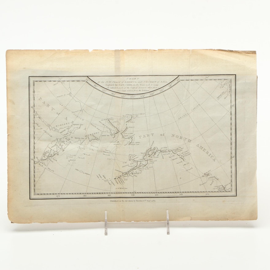
Antique Lithographic Map of American and Asian Coasts
Item Details
Not Signed
An antique lithographic map of American and Asian coasts. This antique map shows the northeast coast of Asia and the northwest coast of North America, which were explored by Captain James Cook in 1778 and 1779. It was published by Harrifon & Co in 1784. The map is not framed or mounted.
Condition
- image is in good condition, folds and toning on the surface, tears and worn edges., writing in pen at the reverse.
Dimensions
14.75" W x 10.25" H x 0.05" D
Item #
17BOS164-059


