


1 / 9
Image 1 of 9


1 / 9
Image 1 of 9
View all items from Art, Rare Books, Home Furnishings & More sale
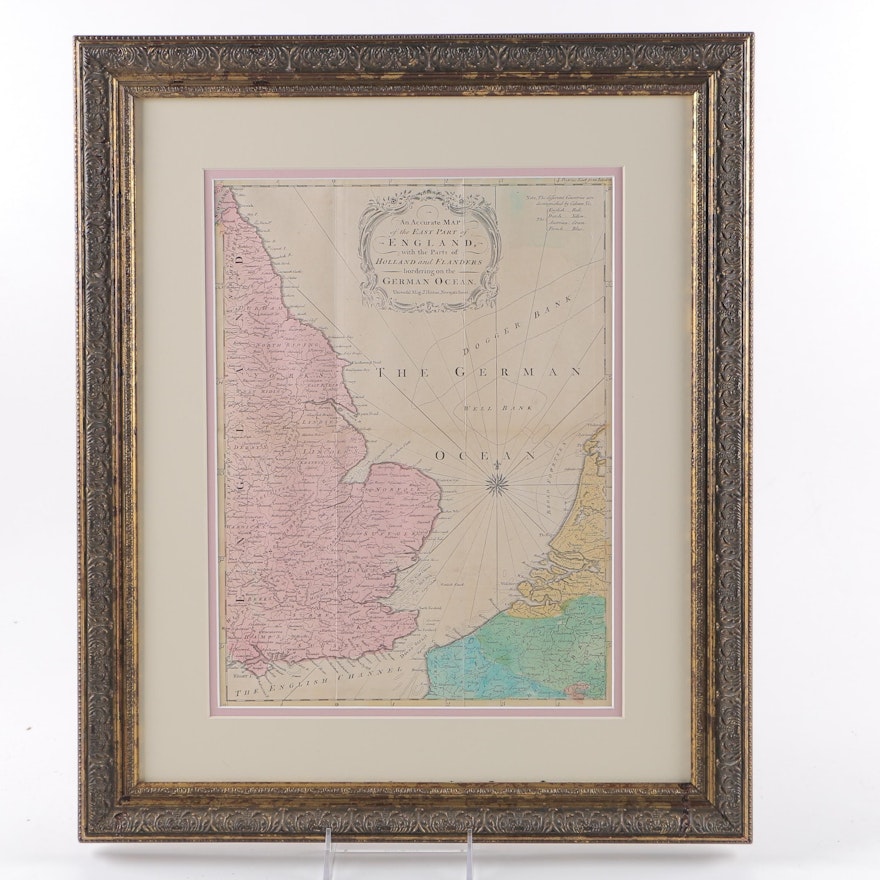
18th Century Engraved Map of England
Item Details
A hand-colored engraving of a map of East England. This piece was engraved by Universal Magazine J. Hinton and is attributed to the year 1760. The map is inscribed, ‘An Accurate Map of the East Part of England with the Parts of Holland and Flanders bordering on the German Ocean.’ It is presented under glass, in a mottled antiqued gold-tone wood frame, with a double mat, and wire for hanging and map information to the verso.
Condition
- there is a substance that has dripped on the frame and splattered on the back.
Dimensions
17.5" W x 20.5" H x 1.0" D
- measured frame; visible image measures 11"W x 14"H.
Item #
17ATL026-007


