


Antique Cherry Wood Rand McNally Map-Tack System Maps
Item Details
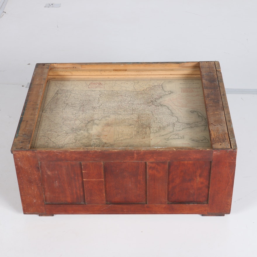
A collection of antique cherry wood Rand McNally Map-Tack System Maps and cabinet. This collection includes eight drawers with pull out knob handles; with each drawer containing a U.S. state map to each side. The red lines on the map represent railroads and the black line represents water routes. The cabinet is one part of a larger map system. It includes rail and panel designs on each side and features a pull-out design whereby the maps are already rolled out for easy viewing. The maps include Arkansas, California, Colorado, Connecticut, Florida, Maine, Maryland/Deleware, Massachusetts, Minnesota, Mississippi, Missouri, Nevada, New Hampshire and Pennsylvania. Each map is stamped ‘Map-Tack System Map’ and for use in the ‘Rand McNally Map-Tack System’.
Condition
- foxing; toning; some maps are ripped and torn with parts of the maps missing.
Dimensions
- measured the whole chest.
Item #
17PIT009-019


