


1 / 9
Image 1 of 9


1 / 9
Image 1 of 9
View all items from Books, Prints, Maps, Autographs, & Magazines sale
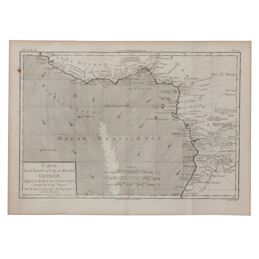
Rigobert Bonne Engraving Map of West Africa, 1787
Item Details
| Medium on Ground | Engraving on laid paper |
| Geographical Area | Africa |
| Region | West Africa |
| Period | Late 18th Century |
| Date | 1787 |
| Artist (Nationality, Lifespan) | Rigobert Bonne (French, 1727 – 1794) |
| Title | Carte De La Haute et De La Basse Guinee, depuis la Riviere de Sierra Leona, jusqu’au Cap Negro |
| Signature | Unsigned |
| Place of Publication | Paris |
| Language | French |
Condition
- curling to the paper; creases and fold marks present; stains and foxing throughout; toning to the paper.
Dimensions
14.0" W x 10.0" H x 0.1" D
- measures the paper; plate measures 13.25" W x 9" H.
Item #
ITMGC66030


