


1 / 9
Image 1 of 9


1 / 9
Image 1 of 9
View all items from Décor, Vintage Prints, Timepieces & Vintage Jewelry sale
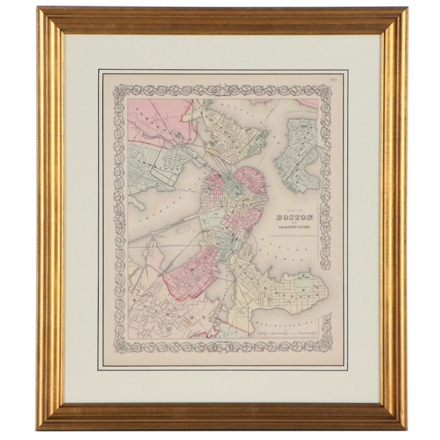
J.H. Colton & Co. Atlas City Map of Greater Boston Area, 1855
Item Details
| Medium on Ground | Hand-colored engraving on paper |
| Geographical Area | United States |
| Region | Boston, Massachusetts |
| Period | Mid-19th Century, Antique |
| Date | 1855 |
| Artist (Nationality, Lifespan) | Joseph Hutchins Colton (American, 1800 – 1893) with sons George Woolworth Colton (1827–1901) and Charles B. Colton (1832–1916) |
| Title | Map of Boston and Adjacent Cities |
| Portfolio and/or Book | Plate number 13 pulled from Colton’s Atlas of the World, volume I |
| Publisher | Published by J.H. Colton & Co. |
| Place of Publication | New York |
| Map Type | City Map |
- Item not examined outside of mounting
Condition
- toning and foxing to page; scratches to finish and handling wear to frame.
Dimensions
21.5" W x 24.5" H x 1.0" D
- measures frame; visible image measures 14.0" W x 17.0" H.
Item #
ITMG818858


