


1 / 14
Image 1 of 14


1 / 14
Image 1 of 14
View all items from Books, Collectibles, Décor & Furniture sale
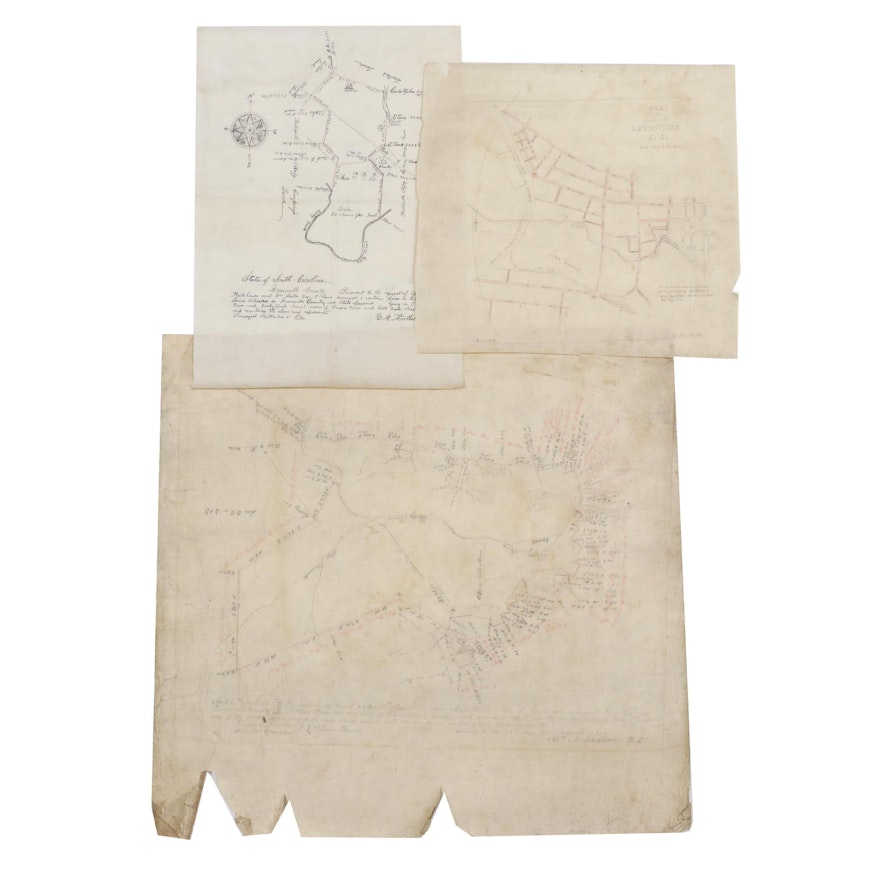
Land Survey Drawings from Greenville, South Carolina, Late 19th Century
Item Details
| Medium on Ground | Ink and pencil drawings on paper and drafting linen |
| Geographical Area | United States |
| Period | Late 19th Century, Antique |
| Date | March 1869, September 1876, and June 1883 |
| Artist (Nationality, Lifespan) | Surveyors William A. Hudson (circa 1838 – 1910), signature appearring to read “V. M. Thretkold”, and St. John Cox (1852 – 1888) |
| Signature | Each is signed and notated by the land surveyor |
| Map Type | Land Survey |
| Inscriptions – Front and/or Verso | Each is inscribed with information relating to the survey presented |
| Additional Information | Lot includes land surveys relating to the conveyance of properties in Greenville, South Carolina. This includes an 1869 document at the request of John Westfield and Alexander McBee detailing 1,050 acres of land, with a later plat map of Greenville from 1883 that notes the areas purchased by Westfield in 1869. Also included is a land survey done at the request of William Lester and Samuel Hutchings, depicting Lester’s land bordering the Batesville Mfg. Company’s land. |
Condition
- varying degrees of toning, foxing, and discoloration to sheets; wrinkled paper, creases throughout, and wear with torn and flaked, brittle edges; smudges to graphite survey plans; sheets tend to curl from rolled storage.
Dimensions
25.25" W x 24.0" H x 0.1" D
- measures the largest of three.
Item #
ITMG114042


