


1 / 11
Image 1 of 11


1 / 11
Image 1 of 11
View all items from Remarkable Finds sale
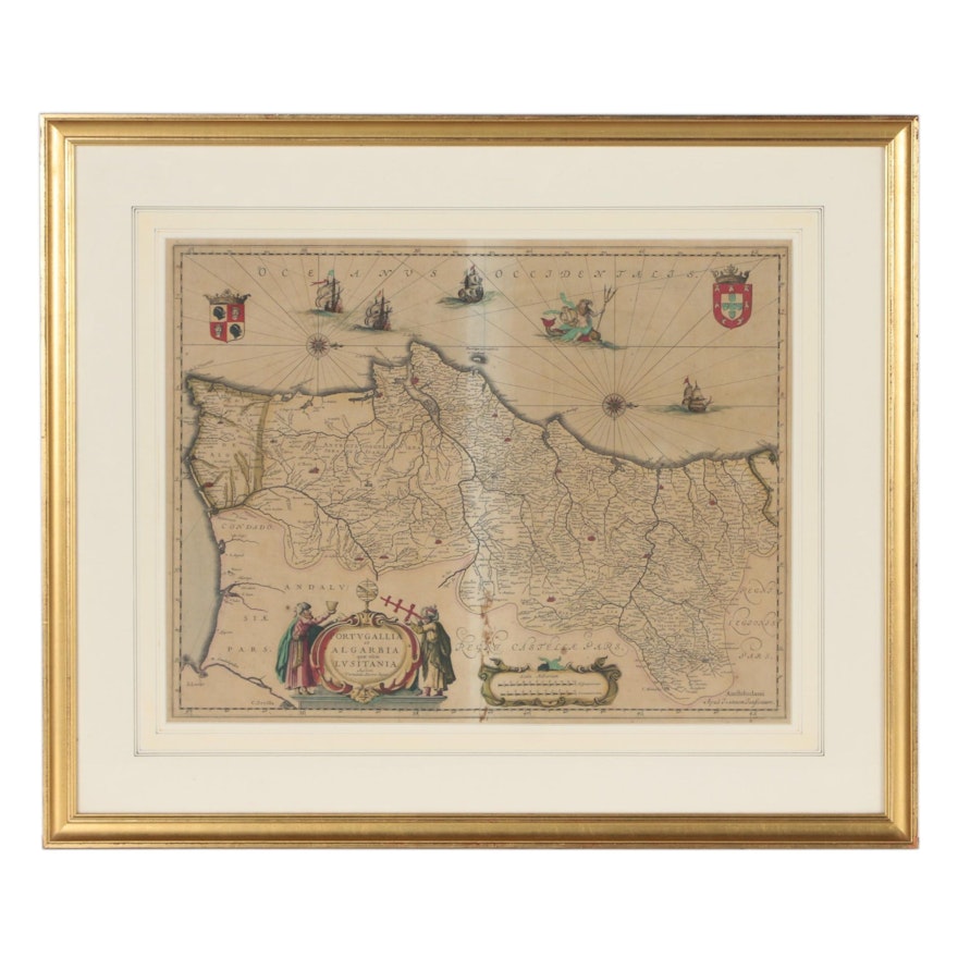
Jan Jansson Atlas Map "Portugallia et Algarbia quæ olim Lusitania", circa 1660
Item Details
| Medium on Ground | Hand-colored engraving on laid paper |
| Geographical Area | Portugal |
| Period | 17th Century |
| Date | Circa 1660 |
| Artist (Nationality, Lifespan) | After Fernando Álvaro Seco (Vernando Alvero Secco, Portuguese, 16th century) |
| Title | Portugallia et Algarbia quæ olim Lusitania (“Portugal and the Algarve, formerly Lusitania”) |
| Signature | Cartographer credit within title cartouche |
| Portfolio and/or Book | Pulled from Jansson’s Atlas Novus |
| Publisher | Published in Amsterdam by Johannes Janssonius (Jan Jansson, Dutch, 1588 – 1664), credit to lower right in plate |
| Map Type | World Atlas, Pictorial/Bird’s Eye Map |
| Labels to frame | Label to verso |
Condition
- toning and foxing throughout; adhesive discoloration and tear to paper to lower portion of center seam; toning is lighter at center from original binding; creases to paper at center line and to right of center; other wrinkles to paper pressed flat at lower center and slight ripple throughout; faded color on mat borders; gilt loss and edge wear to frame.
Dimensions
27.75" W x 23.5" H x 1.25" D
- measures frame; visible map area 20.0" W x 15.5" H.
Item #
ITMG384770


